CAPACITY IMPROVED AFTER ROAD DIET
| Objective | Features | Results |
|---|---|---|
|
|
|


Buffered Bicycle lane
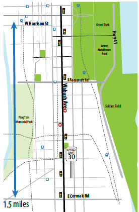
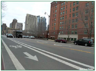
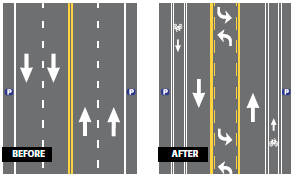
Developing bicycle lanes along Wabash Avenue as part of Chicago's bicycle plan implementation was the city's primary reason for the 1.5-mile Road Diet from Cermak Road to Harrison Street. The cross section of this corridor was originally 4-lanes with on-street parking. It was converted to a 3-lane cross section with on-street parking and buffered bicycle lanes on both sides.
Located just south of Chicago's main business district, "The Loop," the land use on Wabash Avenue is a combination of commercial and service-oriented businesses, as well as institutional, with a college being located in the area. Intersections along the 30-mph corridor are mostly controlled by traffic signals with the exception of two T-intersections that are all-way stop-controlled.
IMPLEMENTATION PLAN
Scheduled to undergo a phased resurfacing plan, the city took the opportunity to install buffered bicycle lanes along Wabash Avenue when the corridor was re-striped. Just north of the entire corridor, Wabash is a one-way street, which provided a logical terminus for the bicycle lanes and the Road Diet. The striping plans created separation between vehicles and vehicles and bicycles with a 2-ft wide painted buffer zone, and it allowed for the addition of left-turn lanes at the intersections. The traffic signals along Wabash Avenue also underwent a signal optimization with the Road Diet conversion to mitigate any traffic operations concerns.
The striping plans created separation between vehicles and vehicles and bicycles with a 2-ft wide painted buffer zone, and it allowed for the addition of left-turn lanes at the intersections.

RESULTS
A capacity analysis using simulation software revealed that capacity improved along Wabash Avenue after installation of the Road Diet and signal optimization.
