USA Banner

Official US Government Icon

Official websites use .gov
A .gov website belongs to an official government organization in the United States.

Secure Site Icon

Secure .gov websites use HTTPS
A lock ( ) or https:// means you’ve safely connected to the .gov website. Share sensitive information only on official, secure websites.

U.S. Department of Transportation U.S. Department of Transportation Icon United States Department of Transportation United States Department of Transportation

Noteworthy Practices

Florida Uses Predictive Methods found in the Highway Safety Manual (HSM) for Alternative Selection in Florida (HSM Case Study 3)

Original publication: Highway Safety Manual Case Study 3: Using Predictive Methods for Alternative Selection in Florida


Background

The American Association of State Highway and Transportation Officials' (AASHTO's) Highway Safety Manual Part C Predictive Method (Chapters 10-12) estimates crash frequency and severity. The predictive method uses equations known as Safety Performance Functions (SPFs) to estimate the predicted average crash frequency as a function of traffic volume and roadway characteristics (e.g., number of lanes, median width, intersection control, etc.). The HSM provides SPFs for rural two-lane, two-way roads; rural multilane highways; and urban and suburban arterials. The predictive method enables informed decision making throughout the project development process, including the selection of alternative roadway designs.

Key Accomplishments

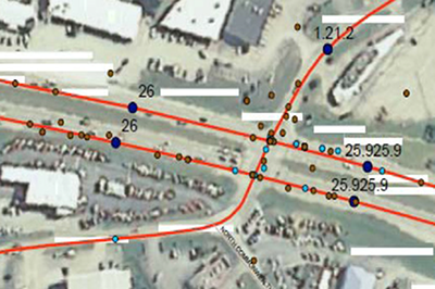
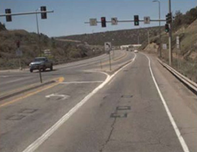
Florida DOT (FDOT) District 7 (Tampa area) volunteered to analyze corridor widening project alternatives on State Road (SR) 574 using the HSM predictive method. FDOT used the predictive method for urban and suburban arterials (Chapter 12) to evaluate the predicted safety performance of each alternative over a 20-year horizon. They used the urban arterial SPFs (refer to HSM equation and tables) and adjusted for the proposed geometric conditions based on the crash modification factors (CMFs) for median width provided in the HSM (Table 12-22).

Results

Based on these results, a four-lane divided alternative was predicted to have a crash cost savings of approximately $4.2 million compared to a five-lane with two-way left-turn lane alternative. A benefit-cost ratio was calculated by dividing the crash cost savings by the difference in right-of-way (ROW) costs.1 The resulting benefit-cost ratio was equal to 2.64, illustrating that the benefit obtained through improvement in crash costs more than offset the differential in ROW costs. The results of this analysis were used to justify the additional ROW costs of the four-lane divided section.

The HSM predictive method enables the design engineer to estimate quantitative safety impacts of various design alternatives and provide justification for their design decisions. For the SR 574 study in particular, the loss of parking at the post office necessary to construct the four-lane divided section, may have been difficult to justify to the post office and the public based on engineering judgment alone. However, the use of the predictive method provided the design engineer with quantifiable evidence on why the four-lane alternative is preferred based on the crash cost savings.


1 Although there are differences in costs associated with construction, ROW was found to have the most significant impact, and therefore, ROW was the only cost considered in the economic analysis.

"Highway Safety Manual logo"

Contact

David O'Hagan
Florida Department of Transportation
(850) 414-4283
David.OHagan@dot.state.fl.us


Florida Highway Patrol Piloting Signal Four Analytics, a Web-based Crash Mapping and Analysis Tool

Original publication: Signal Four Analytics, a Web-based Crash Mapping and Analysis Tool – Florida Highway Patrol(Website)


Key Accomplishments

Traffic crash data is available now in greater detail than ever, but making sense of this data remains a challenge to law enforcement, transportation planners, and traffic engineers. These professionals need powerful, accessible, and affordable tools to explore the spatial and logical relationships that drive decisions on resource allocation and project prioritization. Signal Four Analytics aims to address these needs by providing current crash and streets data paired with interactive analysis and visualization tools, accessible via any modern web browser.

Results

Florida Highway Patrol (FHP) is currently the statewide pilot agency for this system. The GeoPlan Center and FHP are working together to ensure that the system will fulfill the crash analysis needs of law enforcement for identifying critical safety areas in order to apply enforcement education countermeasures effectively to reduce fatalities and injuries on Florida's roadways.

Crash data—long and short form, collected electronically by FHP officers at crash sites throughout the state—is transmitted nightly to the GeoPlan Center and loaded into the Signal Four Analytics database. Live database statistics are shown above and to the right.

Once the pilot phase is complete, Signal Four Analytics will be extended for use to interested traffic engineering, transportation planning, and other law enforcement agencies in Florida.

"Screenshot of the Signal Four Analytics Tool"

Figure 1. Signal Four Analytics Web Interface

"Two enlarged screenshots from the Signal Four Analytics Tool, the first showing data on a map as individual points, and the second showing the same data as clusters"

Figure 2. Crash data can be viewed spatially in the context of a map. The system can present the data as individual points, or collectively as clusters. The map views allow analysts to quickly gain an intuitive understanding of the spatial distribution of crashes.

Figure 3. Crash attributes and derived statistics can be viewed in tabular format. Tables interact with the map view—as records are selected, associated points are highlighted on the map (and vice-versa).

"Screenshot from the Signal Analytics Tool, showing a horizontal bar chart of the distribution of crashes by day of the week"

Figure 4. The distribution of crashes can be charted according to any number of attributes (day of week, for example).

Contact

Major Richard S. Mechlin
Office of Strategic Services, Florida Highway Patrol
2900 Apalachee Parkway, MS-43
Tallahassee, FL 32399
850-617-2377
richardmechlin@flhsmv.gov

Dr. Ilir Bejleri
954-214-7885
Ilir@ufl.edu

Knox and Oldham Counties in Kentucky Use High Friction Surface Treatments to Reduce Occurrence of Road Departure Crashes – Kentucky

Original publication: Every Day Counts Project Case Study: High Friction Surface Treatments – Kentucky Transportation Cabinet (KTC)(PDF, 816kB)


Key Accomplishments

Roadway departure crashes composed nearly 70 percent of the crashes on Kentucky highways. Because these crashes tend to lead to injury or death, the Kentucky Transportation Cabinet (KTC) decided to treat these problem curves as top priority. For any half-mile roadway section having eight or more wet weather crashes over a 5-year period, the KTC proactively applied High Friction Surface Treatment (HFST) using calcined bauxite for the aggregate if the pavement was in good condition.

Results

Oldham County applied HFST in 2009 to treat one horizontal curve. Prior to the HFST, there were 53 wet weather crashes and three dry weather crashes observed over a 3-year period (18.67 average crashes/year). After the treatment, five wet weather crashes and no dry weather crashes were observed over a period of 3.18 years (1.57 crashes per/year).

Knox County installed HFST at one intersection in 2011. The HSFT was installed to address rear-end crashes at the intersection. The friction treatment was only applied on US 25 in the southbound lane, which has a downgrade approach. For a 3-year period prior to the installation, there were six wet weather crashes and 27 dry weather crashes (11 crashes/year). The crashes were mostly rear-end crashes. During the 1.3 years after the installation, there were two wet weather crashes and five dry weather crashes (5.38 crashes/year).

"Photograph of a horizontal curve on KY 22 with HFST installed""Photograph of a horizontal curve on KY 22 with HFST installed"

Figures 1 and 2. Oldham County, KY; KY 22, MP4.36 4.44; HFST Installed In August 2009 to Treat One Horizontal Curve

"Photograph of US 25 Southbound Lane, showing an area being installed with HFST""Aerial photograph of US 25 at its Intersection with KY 1629"

Figures 3 and 4. Knox County, KY; US 25 Southbound Lane, at its Intersection with KY 1629 - HFST Installed In April 2011

Contact

Tracy Lovell
P.E., Transportation Engineer
Kentucky Transportation Cabinet
Tracy.Lovell@ky.gov

Joseph Cheung
P.E., HFST Lead
FHWA Office of Safety
Joseph.Cheung@dot.gov

Wirt and Mercer Counties in West Virginia Use High Friction Surface Treatments to Reduce the Occurrence of Road Departure Crashes – West Virginia

Original publication: Every Day Counts Project Case Study: High Friction Surface Treatments – West Virginia Department of Transportation(PDF, 814kB)


Key Accomplishments

West Virginia has a high number of run-off-the-road crashes. Their goal of applying High Friction Surface Treatment (HFST) at these locations is to reduce the number of crashes. They intend to look at the total number of accidents 3 years after application.

Results

WV DOT officials will look at the total number of accidents 3 years after the application of these HFST treatments.

WV 14 in Wirt County is a typical two-lane road in West Virginia with an ADT of 3400. The site is located at a six-degree horizontal curve. Prior to application, this site had four wet weather crashes in a span of 3 years. No skid testing reading was available prior to the project, but it had a reading higher than 69 after installation. The project was completed in October 2012. The total linear feet of installation is 420.

WV 20 in Mercer County is a two-lane road in southern West Virginia with an ADT of 7200 compromising mostly of commuters. The site is located at a series of horizontal curves. Prior to the application, this site had four run-off-the road crashes in a span of 3 years. No skid testing reading was available prior to the project, but it had a reading higher than 69 upon project completion. The project was completed in August 2011. The total linear feet of installation is 2,200.

"Photograph of an HFST-treated horizontal curve of WV 14 in Wirt County"
Figure 1. Wirt County - WV 14 at MP 15.48


"Photograph of an HFST-treated section of WV 20 in Mercer County"
Figure 2. Mercer County - WV 20 at MP 16.42 between Princeton and Athens, WV


Contact

Donna Hardy
P.E., Mobility and Safety Engineer
WV Division of Highways, Traffic Engineering Division WV DOT
Donna.J.Hardy@wv.gov

Joseph Cheung
P.E., HFST Lead
FHWA Office of Safety
Joseph.Cheung@dot.gov

California Department of Transportation Installs High Friction Surface Treatment on Los Angeles On-Ramp to Reduce Wet Pavement Collisions – California

Original publication: Every Day Counts Project Case Study: High Friction Surface Treatments – California Department of Transportation(PDF, 615kB)


Key Accomplishments

Caltrans Roadway Departure Safety Plan in 2011 identified 179 locations and approximately 50 other locations where High Friction Surface Treatment (HFST) has been or will be placed.

California has placed 10 HFST applications to date. However, 50 additional applications are planned, including one at a high-speed, signalized intersection. The majority of the applications will be for the end of on-ramps and on the curves of two-lane roadways.

"Photograph of the Sepulveda onramp"
Figure 1. Rte. 105 Sepulveda Boulevard onramp in Los Angeles, CA. HFST installed in February 2011


Caltrans is moving forward with the projects as a result of information obtained from other states and information provided during webinars. Based on the information from webinars, Caltrans' specifications call for calcined bauxite only. Previously, Caltrans mainly used open-grade asphalt concrete (OGAC) to reduce wet pavement collisions along with grinding and grooving. However, OGAC could not be installed at locations where there were freezing temperatures. An additional benefit of HFST when compared with OGAC is the ability to install on any pavement surface without concern for cross drainage.

Results

The I-105 Sepulveda Blvd. on-ramp, a primary egress point from the Los Angeles Airport, was notoriously closed during rain events to prevent expected crashes. The average daily traffic is 31,000. Crashes occurred as a result of the tight curvature, the low friction, and aggressive driving by motorists. The closure of this highly utilized ramp resulted in numerous complaints to Caltrans. The latest five years of crash data showed that 68 of the 85 crashes were wet pavement crashes. Since Caltrans applied HFST to about 1,300 linear feet of the ramp, it has not been closed. The pre- and post-application friction values were 32 and approximately 60, respectively. Due to the volumes of crash data processed, post-application crash experience data is not available at this time.

Contact

Robert Peterson
Branch Chief, Caltrans
Highway Safety Improvement Program
Robert.Peterson@dot.ca.gov

Joseph Cheung
P.E., HFST Lead
FHWA Office of Safety
Joseph.Cheung@dot.gov

Ohio DOT Implements New Roadway Safety Management Process with AASHTOWare SafetyAnalyst™

Original publication: Highway Safety Manual Case Study 2: Implementing a New Roadway Safety Management Process with AASHTOWare Safety Analyst™ in Ohio


ODOT's use of AASHTOWare Safety Analyst™ (SA) allowed it to develop multiple screening methods in the network screening process resulting in greater identification of rural corridors and projects.

Issue

Application of the Highway Safety Manual (HSM) and related safety data tools.

Key Accomplishments

“Ohio DOT is excited about the opportunities that SA provides the highway safety engineering community by allowing the end users to easily perform network screenings and countermeasure evaluations with a high level of statistical rigor.”

– Jonathan Hughes, ODOT

  • Establishing a process that advances the capacity to perform roadway safety analysis while also shortening the time needed to conduct the analysis.
  • Improving data collection and data quality.
  • Working with IT staff (a crucial step) to ensure hardware and software needs were met in all offices.

Results

Applying various HSM screening methods identified ways to overcome some of the limitations of existing practices. For example, the agency's previous mainframe methodology typically over-emphasized urban “sites of promise,” or those locations identified for further investigation and potential countermeasure implementation.

Benefits

  • The extensive data gathering effort increased output reliability, allowing the agency to direct safety funds to locations where transportation improvements have the greatest potential to reduce severe (fatal and injury) crashes.
  • A big advantage of AASHTOWare Safety Analyst™—in comparison to the previous mainframe process—is the ability to quickly apply the more sophisticated screening methods within the HSM.
"map of Ohio with highway segments colored to show expected and excess crashes"
Figure 1: GIS Display of Expected and Excess Crashes for Highway Segments


Contact

Jonathan Hughes, P.E.
Ohio Department of Transportation
(614) 466-4019
Jonathan.Hughes@dot.state.oh.us

Idaho Uses Predictive Methods in IHSDM to Evaluate Safety in Idaho 8 Corridor

Original publication: Highway Safety Manual Case Study 1: Using Predictive Methods for a Corridor Study in Idaho


Idaho used FHWA's Interactive Highway Safety Design Model (IHSDM) along the Idaho 8 corridor to evaluate existing traffic, roadway geometry, and predict crashes using these and the corridor's recent crash history.

Issue

Application of the Highway Safety Manual (HSM) and related safety data tools.

Key Accomplishments

“The advantage of employing IHSDM on this project was the opportunity to perform a detailed and simultaneous review within the corridor on a variety of critical elements (that is, traffic operations, geometry, safety) to isolate potential problem areas and allow development of strategic mitigation strategies.”

– Bob Beckman, Project Manager

  • FHWA's Interactive Highway Safety Design Model was used to evaluate the safety and operational effects of existing traffic and roadway geometry on highways. This evaluation, along with the corridor's recent crash history, was used to predict crashes.
  • While the IHSDM is a data intensive program, the time and effort invested in data entry is rewarded through the production of a detailed quantitative safety analysis.

Results

The development of a more advanced safety analysis for the Corridor Study that was data-driven and integrated into the Statewide Transportation Improvement Program (STIP).

Benefits

  • The IHSDM Policy Review and Crash Prediction modules were very useful in identifying existing geometric deficiencies, specific locations needing further evaluation, locations needing possible design improvements, and potential safety issues in the corridor.
  • A Corridor Plan Report was prepared to document the review, analysis, and resulting recommendations of this study to be included in the STIP for future implementation.

"Photograph of a section of Idaho's Highway 8"

Figure 1: Idaho 8 Corridor

"map showing the area of Highway 8 in the Corridor study"

Figure 2: Idaho 8 Corridor Map

Contact

Ken Helm Senior Transportation Planner
Idaho Transportation Department
(208) 799-4229
ken.helm@itd.idaho.gov

Maryland Evaluates the Safety Benefits of Modern Roundabout Intersections Compared to Two-way Stop-controlled Intersections

Original publication: Roundabouts – The Maryland Experience: a Maryland Success Story (FHWA-SA-09-018)(PDF, 548kB)


The National Highway Traffic Safety Administration (NHTSA) data show that approximately 733,000 people were injured and 7,196 were killed in intersection-related traffic crashes in 2008. The Maryland State Highway Administration (MDSHA) was concerned about the high number of crashes at some of its intersections controlled by two-way stop signs.

Recognizing that high approach speeds coupled with drivers violating stop-controls can result in crashes, MDSHA converted five rural, two-way stop-controlled intersections experiencing a high incidence of crashes, many with injuries, to single-lane roundabout intersections.

"Photograph of a warning sign showing counterclockwise rotating arrows that indicate a roundabout is ahead"
Figure 1:   Roundabout warning sign
Source: Maryland State Highway Administration (used with permission)


"Diagram showing the eight potential vehicle conflict points on a standard two-lane roundabout"
Figure 2:   Eight vehicle conflict points
Source: FHWA Roundabouts: An Informational Guide


""Diagram showing the 32 potential vehicle conflict points on a standard two-lane roundabout
Figure 3:   32 vehicle conflict points
Source: FHWA Roundabouts: An Informational Guide


Key Accomplishments

As the Maryland experience demonstrates, roundabouts can effectively improve safety and reduce traffic crashes and their resulting injuries and/or fatalities.

Results

The roundabouts installed at these Maryland stop-controlled intersections cumulatively reduced total crashes by approximately 69.1 percent and injury crashes by 88 percent in a three-year period after the roundabouts were installed. During this same period, the fatal crashes were eliminated, falling from three under the stop-controlled intersection design to zero after the roundabouts were installed.

Contact

Mike Niederhauser
Maryland State Highway Administration
tmniederhauser@sha.state.md.us

Street Lights at Urban and Rural Intersections Reduce Late-Night/Early Morning Intersection Crashes in Minnesota

Original publication: Reducing Late-Night/Early Morning Intersection Crashes by Providing Lighting (FHWA-SA-09-017)(PDF, 467kB)


More than 40 percent of intersection fatalities occur during late-night/early-morning hours. Further, the crash fatality rate during the late-night/early-morning hours is as much as three times greater than during the day (Traffic Safety Facts, National Highway Traffic Safety Administration, 2008). Minnesota and Kentucky were concerned about the high number of crashes at some of their intersections during late-night/early-morning hours.

Recognizing that poor visibility at intersections during late-night/early-morning hours can cause crashes, the States of Minnesota and Kentucky installed lighting at 55 intersections experiencing a high incidence of crashes.

"Photograph of a stop sign illuminated by a street light"
Figure 1:   Evening view of stop sign at intersection
Source: Photo by April Armstrong (used with permission)


Key Accomplishments

As the states' experience demonstrates, providing lighting can effectively improve safety and reduce traffic crashes and their resulting injuries and/or fatalities during late-night/early-morning hours.

Results

The enhanced countermeasure reduced overall late-night/early-morning crashes across these intersections by a weighted average of 35 percent.

Contact

Susan Zarling
Office of Traffic Safety
Minnesota Department of Transportation
susan.zarling@state.mn.us

Colorado Implements Continuous Green T-Intersections to Reduce the Number of Angle Crashes

Original publication: Continuous Green T-Intersections (FHWA-SA-09-016)(PDF, 634kB)


Angle crashes are among the most severe crashes that occur at intersections, including “T- intersections,” across the United States. Research has shown that a primary reason for the high number of crashes is driver inability to judge gaps in opposing traffic. The Colorado Department of Transportation (CDOT) was concerned about the high number of crashes at some of its rural T-intersections controlled by traffic signals.

Recognizing that inadequate stopping sight distance can cause crashes, CDOT installed continuous green T-intersection (CGT) at two intersections experiencing a high incidence of crashes, many with injuries. (These existing intersections met minimum Manual on Uniform Traffic Control Devices standards). The CGT design allows main line through traffic to pass through a signalized intersection without stopping while eliminating conflicting left-turning vehicular movement.

"Photograph of a T-intersection where the signal-controlled through tlane at the top of a T-instersection was converted to a continuous green T. Labels indentify the stem of the T and note the addition of a dedicated left turn lane for trafffic seeking to turn left from the stem of the T onto the flat (top) of the T."
Figure 1:   Aerial view of the CGT in Grand Junction, Colorado
Source: Photo from Zane Znamenacek, CDOT (used with permission)


"Photograph of an intersection that was converted to a continuous green T. Photo is taken from the flat of the T on the approach to the intersection, with the stem to the left. The intersection features a dedicated lane for vehicles turning from the stem onto the flat of the T."
Figure 2:   Westbound on US-160
Photo from David Pickren, CDOT (used with permission).


Key Accomplishments

As the CDOT experience demonstrates, CGTs can effectively improve safety and reduce traffic crashes (particularly angle crashes) and their resulting injuries and/or fatalities.

Results

The safety enhancements installed at these Colorado signalized intersections cumulatively reduced total crashes by 60 percent, injury crashes by 70 percent, and angle crashes by 96.8 percent per year.

Contact

Zane Znamenacek
Region 3 Traffic Operations Engineer
Colorado Department of Transportation
Zane.Znamenacek@dot.state.co.us