USA Banner

Official US Government Icon

Official websites use .gov
A .gov website belongs to an official government organization in the United States.

Secure Site Icon

Secure .gov websites use HTTPS
A lock ( ) or https:// means you’ve safely connected to the .gov website. Share sensitive information only on official, secure websites.

U.S. Department of Transportation U.S. Department of Transportation Icon United States Department of Transportation United States Department of Transportation

Noteworthy Practices

UDOT's Advanced Data Collection Methods Result in Better Quality of Roadway/Asset Data and Improved Internal Management of Data

Summary from: Collection and Use of Roadway Asset Data In Utah Roadway Safety Data and Analysis Case Study FHWA-SA-14-078


Background

The Utah Department of Transportation (UDOT) maintains 5,869 centerline miles1 of roadway and 310 miles of freeway ramps, which together comprise 15 percent of the total roadway centerline miles (41,508) open to the public in Utah. 19,056 of these miles consist of unpaved roads. The UDOT-maintained roads carry 67 percent of the vehicle miles traveled in the State.1

The scope of the case study includes data collected on the State system only. Each road was driven in both directions during data collection, resulting in approximately 12,000 total miles driven.

The data collection effort performed by UDOT was a first-of-its-kind, surveying the entire state roadway network and obtaining a wide set of data elements. LiDAR (a term that combines “light” and “radar”) was used by the selected vendor to collect a variety of asset data. The LiDAR technology creates a three dimensional model of the assets scanned along the roadway, and is performed in a single pass at highway speeds.

Key Accomplishments

  • The Utah Department of Transportation (UDOT) used state-of-the-art data collection methods to collect roadway condition, location and roadway asset data.
  • Within UDOT, Asset Management, Safety, Planning and other divisions are now able to share data and jointly manage the roadway asset data. Other areas within UDOT also benefit from this shared data resource.
  • The roadway asset data are accessible to the public through an online program called UPlan.
  • UDOT used a combination of Federal and state funding to cover the cost of the project for first-round data collection which totaled $2.25 Million: $725,000 of HSIP funds and $825,000 of SPR funds, and $700,000 in State funds.

UDOT surveyed the entire State roadway network and obtained a wide set of data elements.

LiDAR (a term that combines “light” and “radar”) was used to collect the asset data, and was also used to create a three dimensional model of the assets scanned along the roadway.

UPlan was created as an online program to share all of the data needed to plan and program a project. UPlan is a spatial database of locations, location attributes and assets, supported in GIS and used by UDOT, their contractors, and the public.

Results

Through this data collection effort, UDOT has improve their budgeting due to the enhanced knowledge of quantity and quality of roadway assets.

The ability to share access to the roadway information enables divisions to work more closely together.

UDOT's Traffic and Safety Division has enhanced safety analysis through improved roadway attributes and crash data.

Reference

  1. Collection and Use of Roadway Asset Data - The Utah Experiment. Jones, W. Scott. 2013. Roadway Safety Data Partnership Peer Exchange.

Contact

Stan Burns
Director of Asset Management
801-965-4150
sburns@utah.gov

Utah Department of Transportation
Asset Management Division, Traffic & Safety Division
4501 South 2700 West
PO Box 143200
Salt Lake City, UT 84114-3200

Safe Roads Alliance Works with Parents and Other Safety Stakeholders to Parent's Supervised Driving Program

Original publication: 2013 National Roadway Safety Awards Noteworthy Practices Guide Publication FHWA-SA-14-002; 2013


"Kentucky Transportation Cabinet Kentucky’s Network Screening Process"
Press event at Rhode Island DMV HQ for 2012 National Teen Safe Driving Week


"photograph of the nine state program books"
Program books from Alaska, Colorado, Delaware, Idaho, Maine, Massachusetts, Nebraska, Rhode Island, and Vermont


Description of Practice

The Safe Roads Alliance worked with State department of motor vehicles (DMV) staff from around the country, highway safety researchers, academics, behavioral scientists, educators and parents and teens to develop the “best-practices” based Parent's Supervised Driving Program (PSDP). PSDP reaches out to parents of teen drivers at a critical time in the teen learning process. Currently available in 13 States, PSDP is provided to DMVs at no cost in an effort to make the most of the supervised driving period that is generally required as part of graduated driver licensing (GDL). The program includes step-by-step instructions for parents on how and what to teach their teen during the supervised driving process, including practicing in a variety of conditions and focusing on “higher order” driving skills.

Key Accomplishments and Results

Improved support and education for the parents of student drivers.

Contact

Jeff Larson
Safe Roads Alliance
617-429-9601
jeff@saferoadsalliance.org

Local Agencies in Six Louisiana Parishes Produce State's First Regional, Data-Driven Safety Action Plan

Original publication: 2013 National Roadway Safety Awards Noteworthy Practices Guide Publication FHWA-SA-14-002; 2013


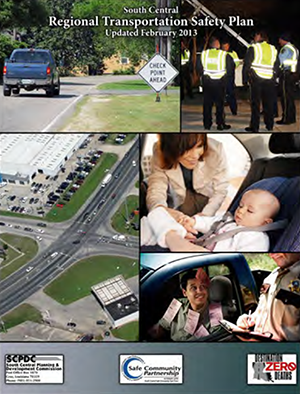
"cover of the South Central Regional Transportation Safety Plan (Updated February 2013)"
Cover of SCRTSP


Description of Practice

The South Central Regional Transportation Safety Plan (SCRTSP) is the first regional, data-driven action plan developed in Louisiana as part of the State's efforts to implement its Strategic Highway Safety Plan (SHSP). The plan is a living document that adopts and disseminates the SHSP “Destination Zero Deaths” goals and strategies down to the regional and local levels. With ongoing support from Federal, State, and local agencies, the SCRTSP uses action plans to undertake regional and local projects addressing four emphasis areas (alcohol-related driving, occupant protection, crashes involving young drivers, and infrastructure and operations).

Key Accomplishments and Results

Measured reductions in alcohol-related serious injuries as well as in serious injuries resulting from lack of seatbelt use.

Contact

Kevin Belanger
South Central Planning and Development Commission
985-851-2900
kevin@scpdc.org

Kentucky Launches Statewide High Friction Surfacing Treatment to Reduce Roadway Departure Crashes on Horizontal Curves

Original publication: 2013 National Roadway Safety Awards Noteworthy Practices Guide Publication FHWA-SA-14-002; 2013


Description of Practice

Kentucky Transportation Cabinet (KYTC) launched a three-year statewide High Friction Surfacing Treatment (HFST) program at over 75 locations in 2010 to improve pavement friction and reduce roadway departure crashes on horizontal curves. HFST was applied at specific sites where skidding crashes resulted in fatalities, serious injuries, and property damage.

Key Accomplishments and Results

There have been measured reductions in the number of roadway departure crashes on treated surfaces.

Contact

Tracy Allen Lovell, PE
Kentucky Transportation Cabinet, Division of Traffic Operations
502-782-5534
Tracy.Lovell@ky.gov

Genesee County (Flint, Michigan) Uses usRAP to Develop Safety Improvement Plan for County Roads

Original publication: 2013 National Roadway Safety Awards Noteworthy Practices Guide Publication FHWA-SA-14-002; 2013


Description of Practice

In 2012, the Genesee County Road Commission (GCRC) in Flint, Michigan, signed an agreement for a U.S. Road Assessment Program (usRAP) Safety Improvement evaluation of the county road system. Initiated in 2004 as a pilot by the AAA Foundation, the usRAP program was designed to assess and benchmark the relative safety of roads using historical crash data and roadway inventory data. The program includes a Road Protection Score (RPS), which can identify road segments with higher crash potential through analyses of road inventory data relative to design features that are strongly correlated with the risk of serious crashes.

GCRC developed the safety improvement plan based on a comprehensive review of the existing physical infrastructure of the county road system. Project staff obtained and assembled data on over 40 existing safety-related infrastructure elements for more than 8,600 300-ft roadway segments. The project database was uploaded to the usRAP Tools software and processed to develop a safety improvement plan.

Key Accomplishments and Results

Assessing and benchmarking the relative safety of roads using historical crash data and roadway inventory data. The development of the plan was completed in early 2013 and is now proceeding to the programming and implementation stage.

Contact

John H. Daly III, Ph.D.
Genesee County Road Commission
810-767-4920
jdaly@gcrc.org

Wisconsin's Information System for Local Roads Expands Local Access to Data while Integrating State and Local Safety Data Systems

Summary from: Wisconsin Information System Local Roads State and Local Data Integration Case Study FHWA-SA-14-037


Background

This case study, available as part of the Federal Highway Administration's (FHWA) Integration of State and Local Safety Data project, describes Wisconsin's efforts to integrate local roadway data into their State data system.

This case study is part of a series of four. Each case study identifies a State's experience collecting local data, the challenges and obstacles faced and how they were overcome, benefits of the practices, reasons for success, lessons learned, and applicability of the practices to other agencies.

The Wisconsin Information System for Local Roads (WISLR) is an example of successful development of a safety and asset management system designed specifically to meet local stakeholder's needs. For Wisconsin, that included developing the new system in a spatial framework that differed from what was already in place for State-maintained roads, and then integrating the State roadway data with the new local roads system to create an all-public-roads database.

Before migrating to the WISLR system, Wisconsin managed the centerline mileage certification process for over 90,000 miles of local roads with more than 1,900 separate paper maps. The Wisconsin Department of Transportation (WisDOT) entered roadway attribute information into a mainframe database accessible only to select State staff, and local agencies received paper copies of local road mileage certification data. There was enormous duplication of effort—local agencies often had their own systems for managing data on roadway miles, assets, and attributes that were not compatible with the existing WisDOT system.

WisDOT launched WISLR in the mid-1990s. It integrates spatial location, asset, inventory, and crash information for local roads using an “on/at/towards” LRS (Linear Referencing System). Users identify the road name (“on”), plus the distance and direction to the nearest intersecting street (“at” or “towards”). This location coding method gains precision by incorporating measured distances along each roadway. WISLR records Intersections at measured distances along that roadway and termini (the ends of the roadways) as the starting (zero) or final distance measurement within a jurisdiction. When a location is specified, WISLR represents that location as the unique combination of the street name and the distance and direction from the nearest intersecting road or terminus. This allows the data for each event or feature to be associated spatially with all other data from the same location. WISLR also includes a translation of State-maintained roadway location, crash, and inventory data into the “on-at-towards” LRS so that WISLR serves as an all-public-roads safety data resource. In Wisconsin, local agencies collect and own the data for roadways under their jurisdiction; the centralized system is available to all authorized users.

Key Accomplishments:

The following are key accomplishments of the Wisconsin Information System for Local Roads:

  • Consistent statewide local roadway data.
  • Cost savings through reduced redundancy.
  • Expanded use by local agencies as new modules and capabilities are added.
  • Efficient tool for safety analysis.
  • All-public-roads LRS and basemap.

Results:

The original purpose of WISLR was to serve as an aid to mandatory recertification of centerline mileage by the local agencies. While State law requires the recertification of centerline mileage, agencies can use any method or software to accomplish the recertification. Even so, compliance is above 90 percent and the vast majority of local agencies use WISLR for data mining and decision-making. The online WISLR user numbers continue to increase each year.

The State is considering upgrades to make the WISLR network representation as high resolution as the state trunk network (STN). This could include turn lanes, medians, dual carriageways and other features not currently captured at the same resolution in the WISLR for the STN making the system even more useful.

Contacts

Susie Forde
Data Management Section Chief
Wisconsin Department of Transportation
608-266-7140
Susie.Forde@dot.wi.gov

Kelly Schieldt
Statewide Local Road Coordinator
Wisconsin Department of Transportation
608-267-9748
Kelly.Schieldt@dot.wi.gov

Stuart Thompson
Federal Highway Administration
202-366-8090
Stuart.Thompson@dot.gov

Tennessee Updates Roadway Information Management System (TRIMS) State Roads Database to Include Local Road Data

Summary from: Tennessee Roadway Information System State and Local Data Integration Case Study FHWA-SA-14-038


Background

This case study, available as part of the Federal Highway Administration's (FHWA) Integration of State and Local Safety Data project, describes Tennessee's efforts to integrate local roadway data into their State data system.

This case study is part of a series of four. Each case study will identify a State's experience collecting local data, the challenges and obstacles faced and how they were overcome, benefits of the practices, reasons for success, lessons learned, and applicability of the practices to other agencies.

Historically, the majority of Tennessee's fatal and incapacitating crashes occurred on local/rural roads; however, local agencies within Tennessee collected very little roadway inventory data and the data collected was largely unavailable to the State. In 2007, the Tennessee Department of Transportation (TDOT) hired a contractor to collect location description and inventory data on all local roads and integrate the information into the Tennessee Roadway Information Management System (TRIMS) database that had been in place for State roads since the 1970s. TDOT's contractor collected data over a five-year period and met TDOT's rigorous data quality standards.

TRIMS is a single integrated linear referencing system database for State and local roadway structures, pavement, traffic, photo log, and crash data. In 2007, TDOT began developing eTRIMS, a map-centric, web-based version of TRIMS with the purpose of encouraging wider use of the TRIMS database. Additionally, the online application supports easier maintenance as users no longer need to install the TRIMS software locally in order to use the system. While TDOT expects that eTRIMS will eventually replace TRIMS, TDOT, local agencies and contractors in all 95 counties in Tennessee have access to both systems.

Key Accomplishments:

The following are key accomplishments of the Tennessee Roadway Information Management System:

  • Improved data accuracy (for both roadway and crash data).
  • One-stop access to all safety information.
  • Data analytic support for State and local agencies.
  • Support for project selection and funding justification.

Results:

Local agencies, by working with the State, use TRIMS/eTRIMS to identify safety needs, select projects, and obtain funding from the State to address safety issues. The integrated system also helps resolve crash data quality issues related to location coding accuracy, completeness, and timeliness.

TDOT is developing a long-term data maintenance method. They have not yet established procedures, but plan to include local agencies in reporting roadway updates in accordance with TDOT's data quality requirements. For now, the State will update data using an overlay on aerial photography as a way to identify major changes.

Contacts

Brian Hurst
Safety Manager
Project Safety Office
Tennessee Department of Transportation
615-253-2433
Brian.Hurst@tn.gov

Jeff Murphy
Information Systems Manager
GIS Mapping & Facilities Data Office TRIMS/E-TRIMS
Tennessee Department of Transportation
615-741-3429
Jeff.Murphy@tn.gov

Bryan Semore
Information Resource Specialist
GIS Mapping & Facilities Data Office TRIMS/E-TRIMS
Tennessee Department of Transportation
202-366-8090
Bryan.Semore@tn.gov

Tom Eldridge
Software Consultant
Intergraph Corporation
Tennessee Department of Transportation
Federal Highway Administration
202-366-8090
Tom.Eldridge@tn.gov

Stuart Thompson
Federal Highway Administration
202-366-8090
Stuart.Thompson@dot.gov

Ohio, with Stakeholder Input, Develops Consistent Mapping and Data Standards for State and Local Roads

Summary from: Ohio Location Based Response System State and Local Data Integration Case Study FHWA-SA-14-036


Background

This case study, available as part of the Federal Highway Administration's (FHWA) Integration of State and Local Safety Data project, describes Ohio's efforts to integrate local roadway data into their State data system.

This case study is part of a series of four. Each case study identifies a State's experience collecting local data, the challenges and obstacles faced and how they were overcome, benefits of the practices, reasons for success, lessons learned, and applicability of the practices to other agencies.

With the majority of public road mileage in Ohio owned and maintained by local agencies such as counties, cities and villages, ODOT (Ohio Department of Transportation) faced challenges with consistency in creating and storing local road maps: there was no single standard and locating crashes on local roads was a “hit or miss” process. For the most part, local road jurisdictions did not have a consistent linear referencing system—many local roadway crash reports referenced approximate street addresses, alias street names, or intersections that no longer existed. Using street addresses as a location reference was problematic because the State road database did not contain address ranges, and the State's list of local street names was often inaccurate. Given that roughly two-thirds of crashes in Ohio happened on non-State roads, this was a significant concern.

To remedy the issue, Ohio integrated the local road system into the State Linear Referencing System (LRS) by assigning consistent route numbers and mileposts to the local roads and then brought the local roadway data into a centralized data system: the Location Based Response System (LBRS). With data standards set by ODOT, each local agency collects, inputs, and field verifies the data in LBRS. LBRS is web-based and the information is available for all stakeholders as soon as agencies enter it. Mapping and analytic tools are available through the website.

Key Accomplishments:

The following are key accomplishments of the Ohio Location Based Response System:

  • Improved location references for crashes on local roads.
  • Consistent mapping and data standards.
  • Easy integration of compliant local data into the State roadway database.
  • More efficient process for conducting safety analyses.
  • Routine updates of State road miles and addressing.
  • Improved data access for the State and local agencies.

Results:

The integration of local and State data via the LBRS proved beneficial for a number of State agencies, as well as the local agencies themselves. At the State level, the improved road centerline and mileposting data has enhanced crash reporting and safety analysis. Ohio now places local road crashes more accurately allowing for better analysis of road safety issues in the counties. The State also now has consistent mapping and data standards for all counties allowing easy integration and improved data access. Finally, this program helps save taxpayer dollars by reducing redundant, and sometimes conflicting, data collection activities. At the local level, one of the most important uses of the LBRS data is for better routing for 911 services by providing more accurate location information for 911 calls and support for next generation 911 implementation.

Ohio plans to improve integration by providing more guidance to local agencies on data maintenance and increasing coordinated communication among the State and local agencies. However, Ohio's experience so far with developing and implementing LBRS shows that there can be successful integration of the local road addressing and mileposting into a State system.

Contacts

Stuart Davis
State CIO/Assistant Director
Ohio Office of Information Technology
614-644-3923
Stu.Davis@oit.ohio.gov

Jeff Smith
GIS Administrator
Ohio Office of Information Technology
614-466-8862
Jeff.Smith@das.ohio.gov

Dave Blackstone
GIS Manager
Ohio Department of Transportation
614-466-2594
Dave.Blackstone@dot.State.oh.us

Stuart Thompson
Federal Highway Administration
202-366-8090
Stuart.Thompson@dot.gov

Michigan's Roadsoft Program Enables Local Agencies to Collect and Maintain Data, while Preserving Local Ownership and Control

Summary from Michigan Roadsoft Integration of State And Local Safety Data


Background

This case study, available as part of the Federal Highway Administration's (FHWA) Integration of State and Local Safety Data project, describes Michigan's efforts to integrate local roadway data into their State data system.

This case study is part of a series of four. Each case study identifies a State's experience collecting local data, the challenges and obstacles faced and how they were overcome, benefits of the practices, reasons for success, lessons learned, and applicability of the practices to other agencies.

One way some States are enabling local agencies to collect and maintain data, while still preserving local ownership and control, is through centrally supported data models like Michigan's Roadsoft program. With Roadsoft, there is no centralized database of local data; local agencies receive a copy of the Roadsoft software to download and maintain locally. However, since Michigan applied a consistent linear referencing system to the local roads, and since most local agencies use the Roadsoft system, the similar structure and data definitions make it easier to share data when needed.

Michigan Technological University's Center for Technology and Training (CTT) developed Roadsoft for the Michigan Department of Transportation (MDOT) as a standardized suite of data management and analysis tools in the early 1990s for local centerline mileage certification and pavement management. Before Roadsoft, local agencies had widely varied levels of access to IT support, software tools and analytic capability. Over time, MDOT and the CTT enhanced Roadsoft to cover a broader range of assets and planning and budgeting support, and to include features such as traffic and crash data for use in safety analysis.

The Roadsoft system meets most analysis needs at the local agency level, but more advanced analyses are not included in Roadsoft. To do such analyses, the local agency must create a data extract to import into any other analysis package. With funding from MDOT, the CTT also supports local agencies with training and analytic assistance. Local agencies are not required to use Roadsoft, though approximately two-thirds of local agencies do.

While MDOT provides Roadsoft to local agencies at no charge, it does not eliminate the costs of data collection. Still, Roadsoft does improve data quality by defining data collection standards, where applicable, within each module. Local agencies are only required to report standard roadway asset and pavement condition data to MDOT for the Federal aid-eligible portions of their network; however, the same standards apply to all data entered into the system. Additionally, Roadsoft has modules for managing a large number of assets and each module was created based on input from local agencies. To help with data collection, Roadsoft has an integrated, GPS-enabled, mobile data collection utility which links Google Maps and Street View, thus creating an inexpensive photo log.

Key Accomplishments:

The following are key accomplishments of Michigan's Roadsoft system:

  • Improved location references for crashes on local roads.
  • Consistent mapping and data standards for all local jurisdictions.
  • Data sharing among local, regional, and State agencies.
  • Efficient process for conducting safety analyses.
  • Comprehensive asset management capabilities.

Results:

The lessons learned from the Roadsoft effort are that long-term support, local agency control, and frequent, gradual, incremental updates, are the keys to Roadsoft's success. The CTT supports the incremental nature of Roadsoft development using a rapid prototyping model with frequent user testing to be sure that the final product meets local users' needs. Local users have a great deal of control over decisions regarding Roadsoft's enhancements—the Roadsoft Users' Group selects and approves each project. MDOT supports Roadsoft by funding the CTT's efforts and by supplying data.

Contacts

Tim Colling, Director
Center for Technology & Training (CTT)
Michigan Technological University
906-487-2102
TKCollin@mtu.edu

Stuart Thompson
Federal Highway Administration
202-366-8090
Stuart.Thompson@dot.gov

Thurston County, Washington, Public Works Department Applies Systemic Safety Project Selection Tool

Original publication: FHWA Safety Program | Systemic In Practice | Washington


Overview of Practice

The Thurston County Public Works Department used the Systemic Safety Project Selection Tool to explore the potential benefits of proactive safety planning. Although Thurston County staff had experience conducting strategic safety planning in partnership with the Washington State Department of Transportation (WSDOT), those efforts focused on site-specific safety improvements such as turn lanes, guardrail enhancement, and shoulder paving and widening.

Results

The Tool provided Thurston County a proactive, data driven and defensible approach to identifying curves for improvement prior to a severe crash occurring, rather than reacting after an incident has occurred. Upon conclusion of the systemic analysis, Thurston County applied for Highway Safety Improvement Program (HSIP) grant funding using the results as documentation for the request. The WSDOT approved the grant and the County is moving forward with implementing the systemic countermeasures identified through this systemic analysis. The Tool also proved to present a process that is flexible and implementable by a local agency with limited funding and staffing resources. A benefit of working with the WSDOT to apply the systemic safety planning process is that the experience provided County staff an opportunity for greater involvement in Strategic Highway Safety Planning (SHSP) activities.

Contact

Scott Davis, P.E.
Traffic Engineering and Operations Manager
Thurston County Public Works
davissa@co.thurston.wa.us