
This chapter describes potential safety issues identified on Federal and Tribal lands as well as a list of potential low-cost countermeasures for addressing these issues. A basic prioritization methodology is also discussed.
What Types of Safety Issues Might I Encounter?
Most issues on or adjacent to Federal and Tribal lands have both an engineering and behavioral element. For example, traffic types and volumes may be inconsistent with the intended roadway design due to changes in the functionality of the roadway and land use in surrounding areas. This may result in a roadway serving mostly commuter traffic, an increase in heavy vehicular traffic, or seasonal traffic peaks and variations. As such, shoulder widths and roadsides may not adequately address the increased risk to drivers. From a behavioral standpoint, lack of awareness of the intended purpose of the roadway may result in motorists not applying the appropriate driving techniques for the conditions. Furthermore, driver expectancy of other road users such as pedestrians and bicyclists may not reflect the intended usage.
The RSA team should determine the safety issues while considering the infrastructure and the behavior elements. Table 2 illustrates common safety issues and behavioral aspects relating to these issues on or near Federal and Tribal lands listed by roadway element. The RSA team is charged with determining specific roadway and behavioral issues for the specific project they are assessing. The documents in the Resource Materials section provide further detail with regard to the issues presented here and to other potential safety hazards that an RSA team should be aware of when conducting a field review.
What are Common Countermeasures?
Table 2 also presents common countermeasures that may be used to address road safety issues on or near Federal and Tribal lands. This list is not comprehensive; it is intended to provide general guidance to typical countermeasures. Note that the countermeasures identified in this list are primarily low-cost engineering measures, although a few relatively high-cost options are included because they are considered to be “proven” countermeasures. A few specific education and enforcement measures are identified as well, but a more general discussion of how to incorporate education, enforcement, and EMS countermeasures is provided in the following section. The documents in the Resource Materials section provide a much wider and detailed range of potential countermeasures and their effectiveness and should be used as guidance when considering safety measures during the RSA process.
Table 2: Common Safety Issues and Countermeasures
| Topic Area |
General Issues |
Example Observations |
Example Countermeasures |
|---|---|---|---|
|
Cross-section |
Limited pavement width |
Narrow or no paved shoulders |
Improve/stabilize unpaved shoulders Install safety edge Install new paved shoulders or widen existing paved shoulders Install centerline or edgeline rumble strips or rumble stripes |
|
Pavement edge drops |
Vertical pavement edge drops greater than two inches |
||
|
Horizontal curves |
Sharp curves |
Limited sight distance |
Install advance curve warning (with/without advisory speed) Install centerline and edgeline pavement markings Improve delineation (e.g., chevrons, post-mounted delineators) Upgrade existing signs (size, retroreflectivity, location) Improve skid resistance with high-friction treatment (e.g., NovaChip, microsurfacing, etc.) |
|
Inadequate superelevation |
|||
|
Various levels of delineation |
Inconsistent and old signing |
||
|
Faded pavement markings; no edgelines |
|||
|
Roadside hazards |
Common roadside hazards located in close proximity to the roadway |
Trees, rocks, utility poles, guide wires |
The order of preference for treating roadside hazards (from most preferred to least preferred) (1) is to:
(1) American Association of State Highway and Transportation Officials (AASHTO). Roadside Design Guide. 2002 3rd Edition with 2006 Chapter 6 Update. |
|
Steep embankments |
|||
|
Drainage features (inlets, headwalls, culverts) |
|||
|
Large bodies of water |
|||
|
Intersections |
Lack of driver expectancy |
Sight distance to the intersection |
Enhance driver expectation of intersections (e.g., advance pavement markings and/or signs, lateral rumble strips) Provide adequate sight distance to intersection Enhance conspicuity of signs and pavement markings (size, retroreflectivity, location, number) Improve line of sight at the intersection/provide clear sight triangles Reduce conflict points by installing turn lanes and consolidating driveways (access management) Provide lighting Consider roundabouts |
|
Obstructions in the sight triangle |
Sight distance at the intersection |
||
|
Driver behavior |
Poor gap acceptance at stop-controlled intersections |
||
|
Lighting |
Roadway and intersection lighting |
Inadequate or lack of lighting |
Install/improve lighting along roadway or at intersections |
|
Pedestrians and bicyclists |
Lack of designated facilities for pedestrians and bicyclists |
No sidewalks or shared use paths and limited shoulders |
Provide designated pedestrian and bicycle facilities Install or widen paved shoulder to a minimum of four feet for use by pedestrians and bicyclists Construct a shared use path Enhance driver awareness of pedestrians, bicyclists, and crossings (e.g., warning signs, pavement markings, standard and/or hybrid signals) Provide median refuge areas Provide educational information to road users with regard to safe use Enforce pedestrian and bicycle laws |
|
Driver behavior |
Lack of driver awareness of pedestrians and bicyclists |
||
|
Pedestrian and bicyclist behavior |
Lack of familiarity with road network and safety issues (tourists) |
||
|
Animals |
Open range livestock |
Roadside grazing |
Enhance driver awareness of animals and animal crossings (e.g., signs) Install animal/wildlife fencing to reduce the number of potential conflict points Construct wildlife crossings (i.e., overpasses and underpasses) along primary migratory/feeding routes Enact and enforce laws to prohibit grazing within the right-of-way Educate owners about animal control laws and liability |
|
Wildlife |
Annual migration routes |
||
|
Speed management |
High vehicle speeds |
Limited enforcement due to large jurisdictions |
Coordinate with local enforcement to conduct targeted speed enforcement Consider alternative measures (e.g., speed trailers) Install gateway treatments at the entrances to towns |
|
Vehicle mix |
All Terrain Vehicles (ATVs)/Snowmobiles Trucks and buses |
ATVs or snowmobiles on and along the roadway |
Provide educational information to road users with regard to safe operating/use Install warning signs and markings to indicate ATV/snowmobile crossings Inform ATV/snowmobile riders of appropriate/designated trails Coordinate with local enforcement Support educational campaigns by enforcing ATV/snowmobile operations Provide sidewalks or shared-use paths to separate non-motorized road users |
|
Access to facilities and communities |
Location |
Limited sight distance/awareness of facilities |
Enhance driver awareness of facilities/communities (e.g., advance warning signs and/or guide signs, gateway treatments) Clear sight triangles at entrances/exits Separate turning vehicles by installing left- and/or right-turn lanes Install shared use path or provide an adequate shoulder to separate pedestrians and bicyclists from motor vehicle traffic Conduct a parking study Identify current occupancy and determine needed capacity Identify opportunities to provide better connectivity between parking facilities and pedestrian/bicycle generators |
|
Parking |
Limited capacity (spillover) Lack of connectivity to destinations |
How Can I Incorporate Education, Enforcement, and EMS Countermeasures?
Safety issues cannot be completely addressed through engineering alone. The other “E’s” include education, enforcement, and emergency medical services (EMS). The RSA team should encourage and suggest measures that consider all “4 E’s” to address specific safety issues. Communication and coordination among the “E’s” is essential to ensuring safety is addressed at a comprehensive level. The agencies conducting RSAs may need to regularly assemble representatives from each of the “4 E’s” to ensure that countermeasures and strategies are complementing one another. Some examples of education, enforcement, and EMS countermeasures are presented below; NCHRP Report 622 provides a more complete description of countermeasures that may aid education, enforcement, and EMS safety strategies (see Resource Materials section for complete reference). Although the report is based on countermeasures targeting a State Highway Safety Office audience, the information provided may be applicable to safety issues observed by Federal and Tribal agencies.
Education – All road users must be aware of the safe and proper way to use roads. Due to the unique characteristics of Federal and Tribal land roadways, users need to be made aware of safe travel practices and potential hazards. Example methods of transferring this information include postings on the internet, brochures provided at visitor’s centers, and video messages. Additional information on effective education strategies may be acquired through outreach groups such as Tribal Technical Assistance Programs (TTAPs).
Enforcement – Laws are intended to control the operation of road users. Enforcing speed limit and compliance with signal/sign indications, as well as correcting wrong-way riding and impaired driving create a safer travel environment for all road users. Staffing and funding constraints may limit the ability of a Federal or Tribal land agency to provide comprehensive enforcement; however, efforts should be made to target specific issues or frequent or high-risk behaviors. This can be done by identifying prevalent factors that contribute to crashes along the roadway of interest and targeting behaviors that relate to those issues. For example, if alcohol was determined to be a primary contributing factor in 50 percent of fatal and injury crashes along a specific route, it may be appropriate to deploy a checkpoint to combat drinking and driving; this could be further targeted by identifying the time of day and day of week when this behavior is most likely to occur.
Law enforcement on RSAs is helpful to identify safety issues as well as to suggest targeted enforcement countermeasures.
Emergency Medical Services – The rural nature of many roadways on or near Federal or Tribal lands may play a major role in limiting the ability to provide timely medical treatment to people injured in a crash. Factors contributing to response time include the ability of other motorists to identify a crash and to notify emergency personnel, the ability of emergency personnel to quickly respond to the scene, and the ability to quickly transport the victim(s) to a trauma center. Adequate cell phone service coverage and routine patrols are a few methods that can help save a life in the event of a serious injury.
How Do I Prioritize Issues?
A prioritization process is useful for identifying the most pressing safety needs based on the findings of the RSA team. Table 3 is a matrix that can be used in the prioritization process. In general, issues associated with more frequent crashes and higher severity levels tend to be given higher priority. The prioritization can be based on historical crash data, expert judgment (provided by the RSA team), or a combination of the two.
Table 3: Issue Prioritization Matrix
| Frequency of Crashes |
Severity of Crashes |
|||
|---|---|---|---|---|
|
Possible/Minor Injury |
Moderate Injury |
Serious Injury |
Fatal |
|
|
Frequent |
Middle-High |
High |
Highest |
Highest |
|
Occasional |
Middle |
Middle-High |
High |
Highest |
|
Infrequent |
Low |
Moderate |
Middle-High |
High |
|
Rare |
Lowest |
Low |
Middle |
Middle-High |
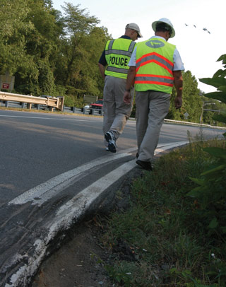
For many RSAs conducted in rural areas, reliable crash data are not available. Anecdotal information (e.g., from maintenance, enforcement call logs, land owners) and evidence of conflicts and crashes (e.g., skid marks and fence strikes) help to create a more complete picture of potential hazards, but cannot be quantified with any certainty. In these cases, the likely frequency and severity of crashes associated with each safety issue are qualitatively estimated, based on the experience and expectations of RSA team members. Expected crash frequency can be qualitatively estimated on the basis of exposure (how many road users would likely be exposed to the identified safety issue?) and probability (how likely was it that a collision would result from the identified issue?). Expected crash severity can be qualitatively estimated on the basis of factors such as anticipated speeds, expected collision types, and the likelihood that vulnerable road users would be exposed. These two risk elements (frequency and severity) are then combined to obtain a qualitative risk assessment.