
Road Safety Audits/Assessments (RSAs) are a valuable tool used to evaluate road safety issues and to identify opportunities for improvement. The Federal Highway Administration (FHWA) defines an RSA as a “formal safety performance evaluation of an existing or future road or intersection by an independent, multidisciplinary team.” RSAs can be used on any type of facility during any stage of the project development process.
RSAs examine roadway and roadside features that may pose potential safety issues.
Some element of safety is considered on every project. However, sometimes conditions on or adjacent to Federal and Tribal lands merit a more detailed safety review. For example, traffic volumes on a roadway may be higher than intended or may carry a higher percentage of trucks and other heavy vehicles due to unanticipated growth. These conditions can divide a Tribal community or interject a set of complexities to an unfamiliar visitor. RSAs examine these conditions in detail by pulling together a multidisciplinary team that looks at the issues from different perspectives – perspectives which are often not a part of a traditional safety review. RSAs also consider safety from a human factors point of view which aims to answer the following questions: How and why are people reacting to the roadway conditions? What do people sense and how do they react to those senses? What are the associated risks with those elements? The multidisciplinary team approach helps to answer these questions. Interactions between all road users (e.g., pedestrians and motor vehicles, commuter traffic and recreational vehicle traffic, bicycles and motor vehicles, etc.) are investigated to determine potential risk and to identify programs and measures to help reduce those risks and create safer environments for all road users.
Partner Agencies
- FHWA
- Tribal Governments
- Bureau of Indian Affairs
- U.S. Forest Service
- National Park Service
- U.S. Fish and Wildlife Service
- Bureau of Land Management
- Department of Defense
- Tennessee Valley Authority
- Bureau of Land Reclamation
- Tribal Technical Assistance Program
RSAs have proven to be a leading tool for improving safety on and along roadways. As such, the use of RSAs continues to grow throughout the U.S. A decade ago, few states had experience conducting RSAs; now each state has had some experience with the RSA process. The success has led to FHWA including the RSA processas one of its nine “proven safety countermeasures.” Federal Land Management Agencies (FLMAs) and Tribes are beginning to witness the benefits of conducting RSAs. FHWA Federal Lands Highway (FLH) division offices have helped plan or conduct RSAs on facilities owned by the National Park Service (NPS), Bureau of Land Management (BLM), U.S. Forest Service (FS), U.S. Fish and Wildlife Service (FWS), and several Tribes. The U.S. Fish and Wildlife Service has included RSA findings in planning and programming documents. Western Federal Lands Highway Division (WFLHD) has used RSAs in their project selection process. Tribes such as the Tohono O’odham Nation have worked with State and local agencies to conduct RSAs and implement RSA findings. However, while RSAs have secured a foothold with FLMAs and Tribes, more opportunities exist to promote RSAs as a tool to address safety on and adjacent to Federal and Tribal lands. Some examples include introducing FLMAs and Tribes to the RSA process, initiating full-fledged programs within agencies, and incorporating RSAs into the planning process, thus promoting a more comprehensive approach to addressing safety.
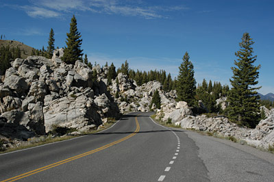
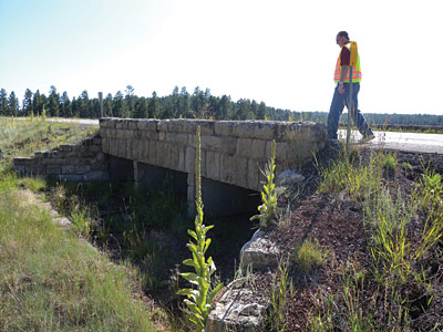
RSAs on Federal or Tribal facilities may encounter unique geometric and roadside conditions with significant historical, cultural, and environmental constraints.
Conducting an RSA does not require a large investment of time or money. RSAs require only a small percentage of the time and money needed for a typical roadway project. Furthermore, by gaining a better understanding of the safety implications of roadway and roadside features, RSAs can be used to prioritize locations with safety issues which help identify the best use for funding. Other benefits include encouraging multidisciplinary collaboration beyond the RSA, which promotes a better understanding of road user needs and safety.
RSAs will help save lives and reduce injuries. The success of RSAs has led to FHWA adopting the process as one of its nine “proven safety countermeasures.” The success has been realized by many FLMAs and Tribes, which are planning and/or conducting a number of RSAs with various partners.
Perhaps the best way to describe the effectiveness of RSAs is through a benefit/cost (B/C) ratio. A benefit/cost ratio is a measure to compare the benefits derived from the reduction of crashes to the cost of conducting an RSA and implementing crash reduction strategies. Benefit/cost ratios may be used as the ultimate measure of the project’s success. The following case studies show the potential benefits of conducting RSAs.
RSA Success Stories
|
Roadway
 |
Intersection
 |
This Toolkit is intended to be used by Federal land agencies and Tribal governments as guidance and to provide information, ideas, and resources in key topic areas to lead the effort to improve safety through the use of the RSA:
- How do I conduct an RSA?
- What are common safety issues and potential countermeasures?
- How do I establish an RSA program?
- How do I incorporate RSAs in the planning process?
- What’s next?
The Toolkit serves as a starting point, providing information to FLMAs and Tribes about identifying an RSA champion, partnerships needed to build support, available funding sources (for both the program and improvements), tools to conduct RSAs, and resources to identify safety issues and select countermeasures. Worksheets and other sample materials have been provided to aid in the RSA process, including requesting assistance, scheduling, analyzing data, conducting field reviews, and documenting issues and suggestions. Examples of programs and experiences of other agencies have also been included throughout to provide examples of successes and struggles in implementing RSAs and improving safety for all road users.
List of Terms
| Term | Definition |
|---|---|
| “4 E’s” | Engineering, Education, Enforcement, and Emergency Medical Services |
| ADOT | Arizona Department of Transportation |
| B/C | Benefit/Cost |
| BIA | Bureau of Indian Affairs |
| BLM | Bureau of Land Management |
| CCP | Comprehensive Conservation Plan |
| CFLHD | Central Federal Lands Highway Division |
| COG | Council of Governments |
| DOI | United States Department of the Interior |
| DOT | Department of Transportation |
| EFLHD | Eastern Federal Lands Highway Division |
| EMS | Emergency Medical Services |
| FHWA | Federal Highway Administration |
| FLH | Federal Lands Highway |
| FLMA | Federal Land Management Agency |
| FS | United States Forest Service |
| FTA | Federal Transit Administration |
| FWS | United States Fish and Wildlife Service |
| GMP | General Management Plan |
| HSIP | Highway Safety Improvement Program |
| IHS | Indian Health Service |
| IRR | Indian Reservation Roads Program |
| ITCA | Inter Tribal Council of Arizona |
| LTAP | Local Technical Assistance Program |
| MPO | Metropolitan Planning Organization |
| NCHRP | National Cooperative Highway Research Program |
| NEPA | National Environmental Protection Agency |
| NPS | National Park Service |
| NRDOT | Navajo Region Division of Transportation |
| PLHD | Public Land Highway Discretionary Program |
| RFP | Request for Proposal |
| RPC | Regional Planning Commission |
| RSA | Road Safety Audit/Assessment |
| SRTS | Safe Routes to School Program |
| STIP | Statewide Transportation Improvement Program |
| STP | Surface Transportation Program |
| TE | Transportation Enhancement |
| THSIP | Tribal Highway Safety Improvement Project |
| TIP | Transportation Improvement Program |
| TTAP | Tribal Technical Assistance Program |
| TTIP | Tribal Transportation Improvement Program |
| UDOT | Utah Department of Transportation |
| WFLHD | Western Federal Lands Highway Division |
| WisDOT | Wisconsin Department of Transportation |