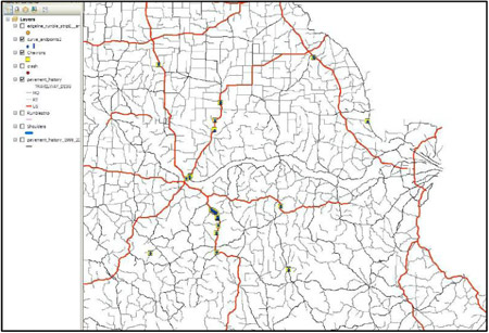
One of the underlying factors of the MIRE data elements is that they are capable of being linked through a common relational location referencing system. A goal for each State would be to have such a common relational location referencing system (i.e., geographic information system, linear referencing system, etc.) for all public roads. If all crash locations are referenced to the same system, then the State can identify high crash locations on all public roads. If inventory data elements for the full roadway system are also referenced to the same system, then the State can use the more advanced high-crash location methods such as SafetyAnalyst.

Figure 1. Example of GIS network in Missouri that allows for likages with data for safety analysis
In most States, development of a common referencing system for all public roads will require significant effort and cooperation with local agencies. The Highway Performance Monitoring System (HPMS) requires geographic information system (GIS) based referencing for all roads in the Federal-aid system (4). This system includes all roads in all functional classification except for rural minor arterials and rural and urban local roads. However, there is significant mileage in these three classifications. Some local agencies have developed or are in the process of developing their own GIS based referencing system for their roads with inventory data referenced to this system. The State may be able to incorporate these referencing systems into their own basemap. Once the referencing systems are combined, attribute data for additional mileage can be added when either the State or the local agency develops or expands its inventory. And, as stated above, this will lead to the ability to link crashes with inventory and traffic data, enabling the State to use the more advanced problem identification methods on more and more miles of public roads.
