
Using Google Earth
Before using Google Earth, assign a geographic coordinate system to the DGN Model.
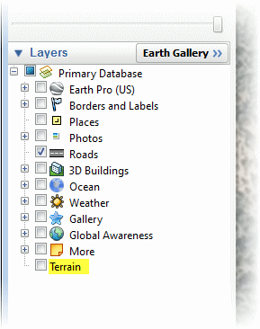
Open the Google Earth application separate from MicroStation. On the Google Earth Sidebar, under Layers, uncheck the Terrain button to enhance operations.
Open or create a 3D DGN Model with a Geographic Coordinate System assigned. A working 3D dgn with nested references of a horizontal alignment is typical. Several of the Google Earth tools can be used in 2D.
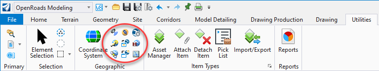
The Google Earth tools are located with the Geographic commands in the toolbar. From MicroStation/ORD go to either the Drawing or OpenRoads Modeling workflows, Utilities tab, Geographic area, and select a tool.
Export Google Earth (KML) File
This feature exports the DGN drawing elements to a Google KMZ file. This file format can be shared easily without the need for MicroStation and can opened with the free version of Google Earth. Many other programs can use the kmz format as well.
First Select Google Earth Settings:
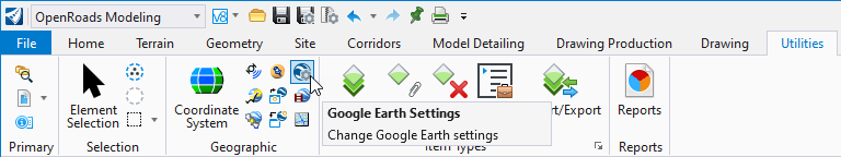
Adjust to typical settings below. Note, converting undisplayed levels may allow the export of sensitive data. Then Select OK.

Select Export Google Earth (KML) File:
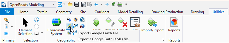
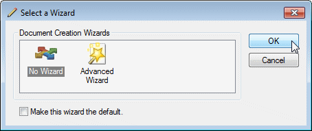
Next, Select No Wizard, then Select OK.
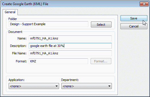
Name file and use a description. Next Select Save. Note, the file will be created with KMZ format.
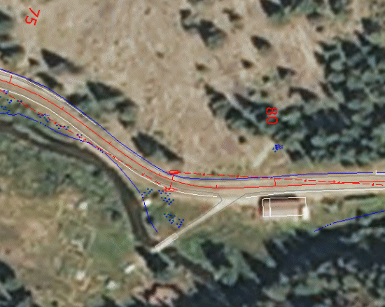
Allow to process. Next, open the newly created KMZ file in Google Earth. Google capture shown.
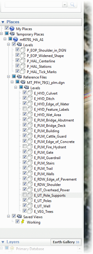
Note the levels available in Google Earth:
Last updated: Wednesday, March 20, 2024