Important Notice Letter
Rev: Apr-2011
Include this notice when providing CADD files to the construction contractor.

An official website of the United States government
Official websites use .gov
A .gov website belongs to an official government organization in the United States.
Secure .gov websites use HTTPS
A lock ( ) or https:// means you’ve safely connected to the .gov website. Share sensitive information only on official, secure websites.
Rev: Apr-2011
Include this notice when providing CADD files to the construction contractor.
Rev: Dec-2025
Checklist for transmittal of design information to Construction to be completed prior to award date.
Attach the Important Notice Letter when including CADD files.
Rev: April-2026
Template for documenting project information about the project for use during construction.
Rev: Jan-2014
Document used for tracking information used by the roadway design software for a specific project. The current version of the form is set up for GEOPAK. See also the example.
Rev: Dec-2025
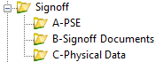
Index for Design Book with typical items included in each section.
Revised: 15-Nov-2024
PS&E Assembly and ReviewTo be completed prior to project Signoff.
Note: This form is not viewable within a web browser. Download the document for viewing and use.