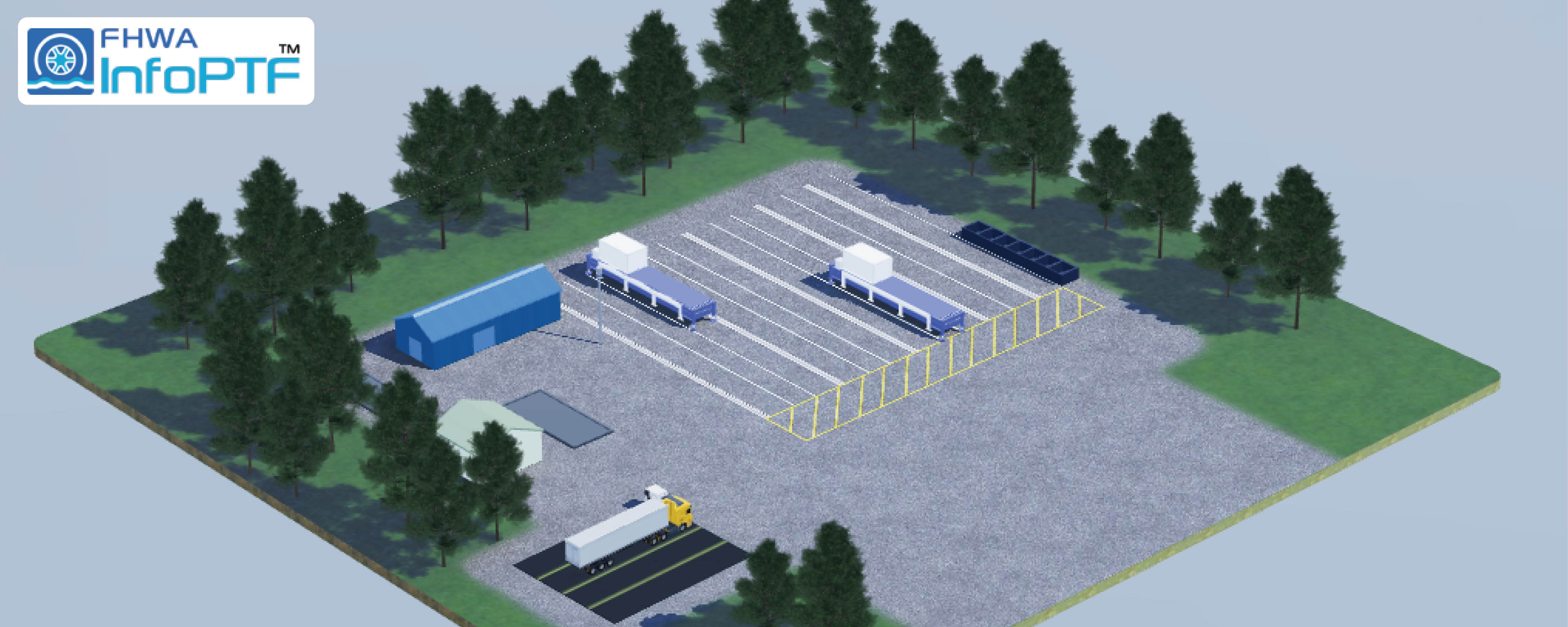
USA Banner

Official US Government Icon

Official websites use .gov
A .gov website belongs to an official government organization in the United States.

Secure Site Icon

Secure .gov websites use HTTPS
A lock ( ) or https:// means you’ve safely connected to the .gov website. Share sensitive information only on official, secure websites.

Site Notification

Site Notification

U.S. Department of Transportation U.S. Department of Transportation Icon United States Department of Transportation United States Department of Transportation
OFFICE OF RESEARCH, DEVELOPMENT, AND TECHNOLOGY AT THE TURNER-FAIRBANK HIGHWAY RESEARCH CENTER

STAC Data

The safety data from the second Strategic Highway Research Project (SHRP2) comprise two large databases: a Naturalistic Driving Study (NDS) database and a Roadway Information Database (RID). The NDS data provide a wealth of information regarding driving behavior. The RID database is a companion database that measures roadway elements and conditions. These two databases are linked, providing an unprecedented resource to study driver behavior within the context of actual roadway characteristics and driving conditions.

The NDS provides objective information on what preceded crash and near-crash events, and identifies what drivers actually are doing during real-world driving conditions. In the SHRP2 study, more than 3,100 volunteer drivers in six locations had their cars outfitted with miniature cameras, radar, and other sensors to capture data as they went about their usual driving tasks.

The RID is a geodatabase that contains detailed information about the roadway characteristics in and around the NDS study cities. The six sites where NDS data were collected are: Seattle, WA; Bloomington, IN; Buffalo, NY; State College, PA; Durham, NC; and Tampa, FL. New roadway data were collected consistently across these six NDS sites in accordance with project specifications on 12,500 centerline miles using automated data-collection vehicles. Existing roadway and other relevant information covering approximately 200,000 centerline miles were obtained from government, public, and private sources and include crash histories, traffic, weather, work zones, and safety campaigns.

"The image shows a map of the United States with the six SHRP2 Naturalistic Driving Study sites highlighted, which include Seattle, Washington, Bloomington, Indiana, Buffalo, New York, State College, Pennsylvania, Durham, North Carolina, and Tampa, Florida. "


RID data were collected on the majority of roadway segments used by NDS drivers for a period of 3 years. Mobile van collected data have been organized into frequency tables to show clearly the type and extent of RID data. The Data Visualization Center has converted these data to a visual format, utilizing bubble charts to easily communicate the range of RID data available for different roadway characteristics.